A New Map of the North East Coast of Asia, and North West Coast of America, with the late Russian Discoveries. Published in the London Magazine in 1764. The Explorations of Captains Behring and Tschirkows, on the St. Peter and St. Paul, from Kamtschatka on the Russian mainland to the northwest coast of North America, from 1728 to 1741.
Chart of Norton Sound and of Bherings Strait made by the East Cape of Asia and the West Point of America. Captain Cook's exploration of the northwest coast of America and the northeast coast of Asia, one of the most significant voyages of discovery of the late 18th Century, representing a great leap forward in the understanding of the coastline of Alaska.
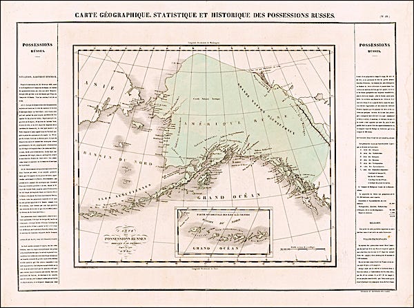
Carte Geographique, Statistique et Historique Des Possessions Russes. By cartographer Jean Alexandre Buchon, 1825, published in Paris, France. One of the earliest antique maps of Russian America, forty-two years before the sale of the territory to the United States in 1867.
Most of the coastline above the Bering Straits is still unexplored; note the indications of interior mountains.
The Territory ceded by Russia to the United States. Compiled for the U.S. Department of State in 1867, by Adolph Lindenkohl. The earliest printed map of lands acquired from Russia and the first appearance of the name ‘Alaska’ on a printed map. Published after the Treaty had been signed, but some months before the actual transfer of Alaska to the U.S. took place.
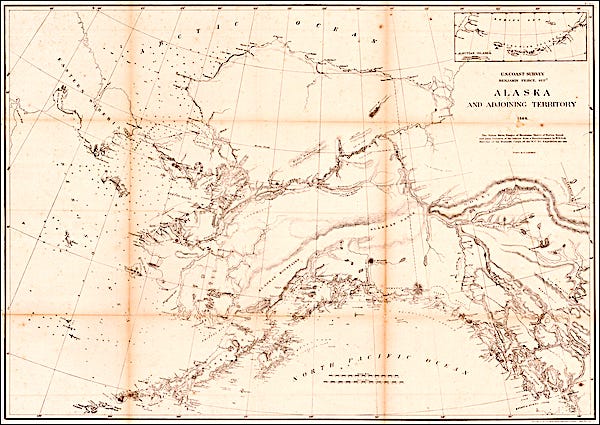
Alaska and Adjoining Territory 1869, United States Coast Survey, by Henry Lindenkohl. Results from the earliest American explorations of the region purchased, showing the Yukon River, mountain ranges, Norton Sound and many features of the interior from a reconnaissance by W. H. Dall, director of the scientific corps, of the Western Union Telegraph Expedition of 1865-1868.
Rand McNally & Company map by Andrew B. Graham, published in Chicago, 1897. After the discovery of gold in the Klondike in 1896, many companies rushed to provide reliable maps for the hordes of hopefuls going north. Rand McNally & Company would soon become a major publisher for guidebooks and maps to the new goldfields in Alaska and the Yukon.


